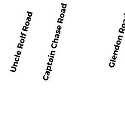
49 UNCLE ROLF ROAD DP
Owner Information
WENSTROM BARBARA A TRUSTEE
24 BONNEY LANE
NORWOOD, MA 02062


Property Details
49 UNCLE ROLF ROAD DP is classified as a Single Family Residential (Cape).
The primary structure on this property was built in 1960. There are 1,197ft2 of built area within this property. There is 1,197ft2 of residential/living space within this property. This property is listed as having 5 rooms.
49 UNCLE ROLF ROAD DP is valued at $385,600. The land is valued at $190,500 and the structures are valued at $194,000. There is an additional valuation of $1,100 on this property.
49 UNCLE ROLF ROAD DP was last sold on Tuesday, September 28, 1993 for $0.
Assessment data from fiscal year 2022.
Flood Data
This property is completely within the AE Zone (within floodplain).
The base flood elevation for this flood zone is 11 feet.
This information is sourced from the FEMA National Flood Hazard Layer. See our full disclamer.
Broadband Internet Providers
| Provider | Type | Bandwidth (mbps) | |
|---|---|---|---|
| GCI Communication Corp. | Satellite | 0 | 0 |
| Verizon New England Inc. | DSL | 5 | 0 |
| Viasat Inc | Satellite | 35 | 3 |
| VSAT Systems, LLC. | Satellite | 2 | 1 |
| HughesNet | Satellite | 25 | 3 |
| Comcast | Cable | 1000 | 35 |
Broadband service provider data from December 2020.
Adjacent Properties
- 46 BAIN ROAD DP
Single Family Residential owned by SANTUCCI SHELLEY J TRUSTEE - 47 UNCLE ROLF ROAD DP
Single Family Residential owned by WELCH RICHARD B ET UX - 50 BAIN ROAD DP
Single Family Residential owned by SISSON RAYMON G ET UX - 51 UNCLE ROLF ROAD DP
Single Family Residential owned by DIANA BRENDA S TRUSTEE